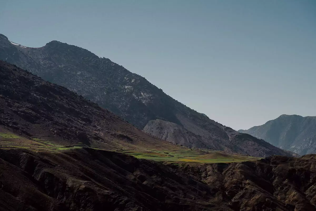
After two interesting days in Marrakesh our road trip over the Atlas Mountains towards the Sahara began. Before the mountains we made a detour into the beautiful Ourika Valley with the mountain village of Setti Fatma: green valleys, red earth and, in the background, the snow-covered peaks of the High Atlas. Wow!
Over the pass and through adobe villages
Then we crossed a pass at a good 2,000 metres to the other side of the Atlas. Instead of the main road we took a smaller country road via Telouet. It was even more scenic and finally led us through beautiful valleys with typical adobe buildings. Our last stop of the day was the Kasbah Aït-Ben-Haddou, an old fortified town on the former caravan route between the Sahara and Marrakesh and today a UNESCO World Heritage Site. The site has been fortified since the 11th century, though the present clay buildings probably date only from the 17th century; it has been a World Heritage Site since 1987. From here the caravans crossed the Tizi n’Tichka, at around 2,200 metres the highest major mountain pass in North Africa.
Before the bare hills of the Ourika Valley, green fields lie on red earth.An adobe building on the hill on the left, the village street on the right, in the High Atlas.Between red hills lies a wooded valley with a village, the Ourika Valley.A tall minaret on the adobe mosque, nothing but blue sky behind it.The green valley on the left, the road towards the snow-covered peaks on the right.A detour into the Ourika Valley: the road follows the river, red rocks, snowy peaks – wow.The hill rises steep and reddish brown, with only bushes on it, in the High Atlas.The valley twice: river and red slopes on the left, fields and snow on the right.Meadow before the village at the foot of striped mountains – the Ourika Valley at Setti Fatma.Trees stand around a village at the foot of the red slope in the Ourika Valley.Prickly pear on the red rock on the left, cypresses before the snowy mountains on the right.Silvery bushes and cypresses stand in the wide valley of the High Atlas.A prickly pear hangs above the green valley with cypresses, in the Ourika Valley.The rock face rises red above the dark trees in the High Atlas.The minaret in the adobe village on the left, red houses seen from the car on the right.A mud-brick house, cypresses and prickly pears on the red earth of the Ourika Valley.On the dry slope an adobe village with a minaret, somewhere in the High Atlas.Hairpins through bare mountains: the pass in the High Atlas lies at about 2,000 metres.Bare ridges of the High Atlas, a little snow still lying on the crest.Folded slopes and a green strip deep in the valley, in the High Atlas.The adobe village in the steep valley on the left, green fields below the rock face on the right.Behind the bare ridges of the High Atlas a snowy peak pushes up.A dark mountain ridge, a green strip running across it, in the High Atlas.A mineral stall by the road, the snowy mountain of the High Atlas behind it.Red and washed out: a hill with bushes under a blue sky.The smaller road via Telouet winds through red hills and bushes.Instead of the main road, the smaller track via Telouet – even more beautiful.A red rocky spur pushes out above a green field in the High Atlas.Up close, the pale rock face, layer upon layer.Orchards between red hills on the left, green fields in the High Atlas on the right.Above palms and gardens a red kasbah crumbles on the slope.An adobe village above green fields on the left, houses on the slope on the right.The village in the valley, with the road and river between the red slopes.The track runs past adobe houses and a green field, in the High Atlas.An adobe kasbah is falling apart on the stony slope in the High Atlas.A mud-brick village with a minaret beneath the red mountain, green fields in front.A gravel track through red eroded hills on the way through the High Atlas.River and trees in the gorge between red rock walls – valleys with typical mud-brick buildings.The rock edge lies in the sun, with nothing but blue sky above.The Kasbah Aït-Ben-Haddou mirrored in the water, UNESCO World Heritage on the caravan route.Battlements and small openings: Aït-Ben-Haddou has been fortified since the 11th century.The woven bag at the barred window on the left, postcards on the wall on the right.Towers of Aït-Ben-Haddou above the riverbed, the way from here leading over the Tizi n’Tichka.A bead necklace on the adobe wall on the left, the yellow wooden door on the right.Towers and palms of the Kasbah Aït-Ben-Haddou, the adobe buildings dating from the 17th century.